Friday, December 29, 2006

KAR.-> Kudremukh Trek


Kudremukh Peak lies in the Western Ghat Range in state of Karnataka and after which the Kudremukh National Park (KNP) and Kudremukh Iron Ore Co. are named.

Why indeed we (Hrishikesh, Brajesh and I Mohit) should be drawn to Kudremukh when we did not have trek-worthy maps, equipments and experience can perhaps only be explained by pictures of these valleys' trademark lush-green carpeted slopes interspersed with thick forested creeks. Nevertheless, this blog will sufficiently disenchant you so that the very name ‘Kudremukh’ shall send a shudder to your spine next time....

http://www.karnatakawildernesstourism.org/Trekking_opp_in/Kudremukh.htm


How to Reach from Mangalore:
* Mangalore to Beltangady (64 km; Rs 31; 2 hr) on NH-13 to Chikmaglur (Dist. HQ in Karnataka not far from Mangalore);

* Beltangady to Navoor (12 km; Rs 10; 20 mins);
* Navoor to Navoor FRH (3 km; Auto Rs. 30);

* Navoor FRH to Kudremukh Peak (18 km trek; take your own sweet time)

24 December 2006 (Might as well have been our last day!)
We had little idea of the Kudremukh-trek’s length and terrain’s difficulty and only knew how to reach the Forest Rest House (FRH) where we expected more guidance. Please take note of how we managed to do most of the things pretty wrong in the start itself:
· Began late from Mangalore Bus terminal at 0745.
· Caught a dilapidated govt bus which ensured we didn't catch a wink for 2 hours, courtesy its state-of-the-art Indian Dolby surround-sound system.
· Overshot Beltangady town by 5kms to reach Ujire and then returned back. At Beltangady, we waited for half an hour, sitting in a private bus, watching it getting stuffed with villagers and their stuff. Once it did start, the next 20 minutes till Navoor village were intimately body-hugging and soul-lifting throughout.
· We walked 3kms from Navoor (where the private bus unboarded us) to the Navoor Forest Rest House (FRH), when we could have simply picked an auto-rickshaw.
· Instead of the anticipated night-pass and guidance for Kudremukh National Park at FRH, we found it locked. ( “If something can go wrong, it will” - Murphy)

After a brief rest at the locked FRH’s altar, we fortunately met a young village chap – Prasanna. This is when we first came to know that Tholali Anti-Poaching Camp (APC) is 12 kms from Navoor FRH and Kudremukh Peak is another 6km further from APC. Also, some Gowda families near Tholali rent out their huts for a night halt. Thanking him, we estimated that that Tholali should be comfortably reached by sun-set. (This day-dreaming was to cost us a dreaded wakeful night later!)

Soon after the FRH we came across the open gate and noted down the Phone number on the board posted some distance away, though Kannada script was incomprehensible to us. The road ahead was metalled and wide but winding. Therefore, once we came across the 0.5 km stone-mound mark, we decided to abandon the winding road and venture into the much steeper and shorter jungle trails which reassuringly crisscrossed the winding road frequently. This was a fine arrangement and we thought that if the road was 12 kms to Tholali APC, the trail will only be lesser, quicker and sporting!

There were no leeches fortunately as rainy season had ended a few months back but the flip side was that the sun was in top form and the jungle was dry.


Slowly, several things began to dawn upon us, each more horrifying than the previous in its import:
Our jungle trek reassuringly crossed the road several times which meant we were on the right track. However, while the lower section of the road was wide and metalled, the upper sections had pitifully crumbled and sported ferns instead of tyre-marks – which meant that the road was not frequented of late at the upper sections of the hill.


The jungle trail too had become much narrow and there were instances where the visibility was less than a meter as several knee-high plants and waist-high grasses had shadowed the boulder-ridden tracks. So, neither rangers nor villagers nor poachers nor encroachers or what have you, came this way either.

Meanwhile, our stock of 3 litres of water had shrunk to just 1 litre and all the waterfalls that we went past had dried up!

Then puzzlingly the jungle trail did not cross the road again!! We do not know for sure whether the road had ended or not as we only remembered that we had crossed the road last time half an hour ago. Anyways, returning back was not much of an option and we decided to continue on our trail further.


For some time, the milestone mounds were coming on the jungle trek as well, and we had to confront the truth that Tholali APC was not 12 kms by road (that too, if the road went till there at all) but 12 kms by this jungle trek and we were still at just 5 km mark!

So, we decided to do some SWOT analysis:
Strength - we are in this together, the trail is ahead of us, the milestones indicate how far we have come from Navoor FRH and we have got adequate ration and sleeping bags.

Weakness – we were in Kudremukh Park without a night-permit, the milestone mounds do not convey how far we have to go or if we were still on the right path, we had little water; the metalled road had gone missing, no mobile connectivity, no human habitation, no arms or torch or tents and increasingly weary legs.

Opportunities – glimpse of Kudremukh Peak and valleys

Threat – Neither the wildlife (rather, a few monkeys did cheer us up) nor the thought of sleeping in the jungle bothered me as much as the fact that the area was Naxalite-ridden (local fire-brand militants); and that an encounter with Naxalite or a case of mistaken identity might not make it to the newspaper editor’s desks!

To put it in a nutshell – we were in a soup.


As we dragged ourselves tight-lipped over the uphill trek, all of a sudden, we heard the lovely sound of fellow beings. We soon exchanged greetings with 2 villagers who were on their way down. In the absence of a common language, Brajesh used some basic Kannada and they too sportingly used some rudimentary English. The good news was that water was available 1 km further at the other side of the hill. The bad news was that Tholali was indeed 12 kms from Navoor by jungle trek and there would be the same uphill trek throughout, without a single habitation to be seen till Tholali.


By 7 km milestone-point, we were arguing whether we would be able to reach Tholali but Brajesh was clear – we were not stopping midway. So we ascended higher – a waterfall here, a spectacular vista there. However, our legs were aching and nothing is more dangerous in an uphill climb than legs rebelling against you even as precipices accompany you throughout.


At 9 km point, when I felt that my knees and tendons had begun to disobey me, even though only slightly, I decided to put my foot down literally. Thankfully by now, Hrishikesh and Brajesh too concurred. So, at 9 km point, a little away from a waterfall and on the trek’s path itself, we dropped down and unloaded. It was 04:30 pm and there was enough time to reach Tholali but our legs refused to carry us further.

And yet, after some massage, we decided to sportingly check our surroundings. The path crossed a small waterfall a little further and there was a 9.25 km mound just before another steep climb began. As we were not game for any more steep climbs, we returned back.


The hills turned ember with the setting sun and we spread the rug at 6 pm on the ground and unzipped the two sleeping bags. I immediately proposed that both Brajesh and Hrishikesh should sleep till 11 pm while I keep vigil. Their readiness to this proposal made me smell a rat. Anyways, the next 5 hours turned out to be my most wakeful hours of life, with a stick in one hand and a knife in the other as constant companion. There was no torch, nor did I use the mobile’s flash as not to attract trouble.

As the night descended, the jungle seems to have acquired life. Some wild cats dueled in the nearby waterfall as perhaps to who shall have me over for dinner (I being the meatiest of us three), and the trees silhouetted against the dark-grey sky rustled even without any perceivable wind as though whispering our accurate geographic locations to all who cared to listen. I was amazed at the tricks a dark eerie jungle can play with even a sane and alert conscience – quite an indelible experience for me. This was indeed a characteristic Christmas Eve, “Silent night, holy night; all is calm, all is bright”!


Turn by turn, we all took guard. The idea was simple – one guy will sleep soundly, one guy will remain vigilant with a stick and knife and the other guy will chatter with him occasionally in the beginning for him to acclimatize with the darkness. The wind was unbearably cold and the vigilant needed two jackets though the sleeping bags were cozy enough.

After just 4 hours of sleep from 11 PM to 3 AM, in which Hrishikesh had been a brave vigilant, they again woke me up and I again remained groggily wakeful till 6 PM, when I decided to kick Brajesh out of the sleeping back. He had occupied the bag successfully for 12 hours! The sky was slightly iridescent at the horizon though it was still not dawn yet when Brajesh finally decided to do his bit for the next 2 hours.

25 December 2006:

Me and Hrishikesh woke up amongst truly beautiful sunlit valleys and stretched ourselves fit. Brijesh had taken several morning snaps by now. The joy was writ large on our faces and all the tiredness and pessimism of the previous day had disappeared much the same way as dews were gone with kiss of the first sun-rays. Today was Christmas and also my birthday! We had bought a plum cake in the beginning, and this was truly the most bizarre birthday I ever celebrated, the others being once in train and another in a railway stationJ.


We began descending by 9 AM and made it pretty quick to the Navoor FRH within 2 hours or so. Overpowered by the joy of descending back to the human milieu, we had sprained our ankles and all found the last mile the most difficult! We met the smiling Prasanna chap again at his field and thanked him and then Brajesh took a quick bath at the locked FRH’s garden tap while I massaged my legs. We were now utilizing the water collected from the waterfalls filtered by my vest as seen in the pic!


Therafter we walked another mile before we pulled up an auto and then the bus from Navoor point to Beltangady town… we reached Mangalore city by 3:30 PM.

The next morning, the newspapers’ front-pages featured the news of a certain notorious Naxalite named Gowda, shot down in the other region of the same Kudremukh National Park while his other two female companions escaped. The anti-Naxalite forces had fired at his refuge in the bushes as they saw a flickering torchlight, and later in the morning recovered his body and ammunitions. Ironically, it seems to have been fortunate for us, not to have packed even something as basic as a torch with us since we too did not have a night-permit nor could comprehend local dialect nor Indian Forces follow such niceties before 'ambushing' make-believe Naxalites.

Kudremukh National Park would remain etched in my memory both as a picturesque and pristine sanctuary and a haunting trek into the wilderness which could have turned tragic. I recommend to others: caution!

Woods are lovely, dark and deep,
But there are warnings to heed!
And miles to go before you peak…
And miles indeed, for I know what I speak.



KAR.-> Mangalore -> Pilikula Nisarg Dham


Pilikula Nisarg Dham is being developed as a one-day outing destination into nature - lake, water park, zoo and science centre - essentially a fun place for family and friends.

Where? 15 kms away from Mangalore (Karnataka) in Vamanjoor area.

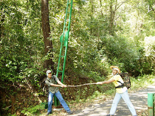
[ On 23 Dec 2007, Brajesh, Hrishikesh and myself (right to left in the pic) enjoyed our half-day tour of Pilikula and hoped to return soon, this time prepared for the water amusement park as well. ]

What All? Pilikula has a:
Lake – (timings:1000 – 1800; Rs 10; camera Rs 25; video camera Rs 100)
As the guide would wax eloquently: A serene lake surrounded by manicured lawns at its periphery of 1 km to take a stroll around or rest under the cool shades of a tree and watch the ducks frolic or better still peddle boat (Rs 40 for 2-seater; Rs 60 for 4-seater). The place is well-frequented on Saturday and Sunday by lovers and college folks. However, a good eatery is missing here.

Biological Park – (timings: 0930-1730; Tuesday closed; same charges as above).

The zoo is small but sufficient for rekindling the childish chuckles even as the place gets swarmed with pupils from several schools, and teachers trying to present some resemblance of order amongst them.
For your eyes only:
CATS: Wild cat, civet cat, Jungle cat, leopard, tiger.
SNAKES: Rattle, pit viper, cobra, russel viper, krait
AQUA: Crocodiles, Common Indian Monitor, tortoise
TERRA: Black buck, deers and sambars


Manasa Water Park – (Rs 190/- and same as above for Cameras). This we did not got to see as we were not.. ahem..well-equipped. (sigh!) But considering the number of private buses that had queued up outside its gate and lively music being played, it must have been good (alas!).

Science Centre and Golf Club are two more features of this area.

How to reach? Bus No. 3 from Mangalore (It sports a big Yellow Tiger logo with ‘Pilikula’ underneath it.)

Advice (Basically everything we did not do) -
1) Carry a decent hat (Sun shines hardest on those who fume the most)

2) Be prepared for thirst (Lake's water is not potable and therefore neither is sold bottlewater ;-))

3) Carry some sports items like frisbee, softball.

4) And most importantly, there is little point in coming out this far by bus, braving the heat and not enjoying the Manasa Water Park (and concomitants). So, carry an extra pair of clothings, and adequate cash.


Hope you pals have a great time.

Tuesday, October 03, 2006

KAR.-> Jog Falls, Gokarna & Murudeshwar

The state of Karnataka offers these three delightful places: Jog Falls which are India's highest falls, Murudeshwar a picnic beach spot and Gokarna beaches for treks and baths in the wilderness.

(In the pic from left to right) Satya SM Naidu, myself- Mohit, Hrishikesh, and Ramakrishna are at Om Beach. We left Mangalore by 0730 Mangalore-Madgaon Passenger train and reached Murudehswar at 1130; alternatively sharing the 2 seats in the general compartment. The second pic is at Murudeshwar, doing pranayam aasan. Soon at lunch time, we discovered that none of us had cashed in from the ATM; that finances were low and no ATM was in sight in Murudeshwar…

Murudeshwar Beach Town offers it all:-

  • A gentle curving beach graced with the speed-boats.
  • A towering temple nearing completion and a beautiful Shiva statue seated atop a nearby hillock amidst the manicured lawns.
  • Hotels and restaurants.
  • Easy connectivity

Gokarna: Town and Beach
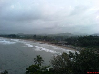
Gokarna is another sea-side town, bigger than Murudeshwar. The town basically appears to be a temple-town with tribal and fishermen communities living together, and has developed rapidly thanks to tourism. Konkani and Marathi influence is perceivable as well. The Gokarna beach is well-frequented and gradual in slope. However, some sand covered rocks can stub you in the feet unexpectedly or can even make you loose your balance.

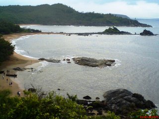
The town’s claim to fame is not just confined to the Gokarna beach and the Lord Shiva's temple next to it, but the series of mystic beaches nestled amidst the hills yonder there - Kudle Beach, Om Beach, Paradise and Half-Crescent Beach. There are no temples, no markets and only a handful of people out on those beaches. Essentially, there is just the sound of waves crashing on the rocks endlessly. Nirvana...

We reached Gokarna by the most uncomfortable way: four back-to-back back-breaking Great Indian Tempo (mini-bus) journey. From Murudeshwar to Honnavar (25 kms), then to Kumta (25 kms), then to Gokarna Cross Road (25 kms) and then to Gokarna town (10 kms). In between, I had cashed in at the ubiquitous SBI ATM at Honnavar (relief!). We lodged at the Savithri Lodge and after a visit to the Gokarna Beach and Shiva temple, had our thalis (Combo meal) at the Pai Restaurant and slept early. Next morning at 0600, we left Gokarna in the dark (both metaphorically and meteorologically) for the famed beaches of Kudle and Om.

Kudle Beach Route- is 20 mins light climb from Gokarna Beach. We walked along the Gokarna Beach for 5 mins to the south, then another 5 mins on the hill road climbing up till a temple and pond compound came. We climbed up the staircase to the hill-top, and found ourselves in the verdant green plateau where we noticed a large boundary drawn up with stones with a pitch in the middle - Cricket. (We expected the rains at this time of the year and had umbrellas for a brief spell of strong rains that occurred near the Cricket ground. It wasn't a show-stopper. ) We crossed the ground and followed a muddy cart-track going down the hill narrowing all the way unto a make shift restaurant under construction by a group of Nepalese!! This is Kudle beach. A series of huts, inhabited by foreigners out here to soak some sun in seclusion, dot the place.

Om Beach Route- was 30 mins walk from Kudle Beach in the same fashion. We walked across the small Kudle Beach for 3 mins to the south and climb up the hill on the beaten track to the hill-top. We decided not to follow the concrete road there but walked across the plateau. It featured the black igneous rocks and small plants planted by the localites. Then, we explored the small region a little and soon noticed the white paint marks heading down the hill to a distant beach. A road also reaches the beach and there is a village resort being built there as well. This is the Om Beach. A ‘Namaste’ restaurant down by the beach side is definitely to be recommended here - they offer internet, taxi booking, foreign exchange and an excellent bouquet of meals.

Similarly further south after the Om Beach are the Paradise and Half Crescent Beaches..

By 0930 at Om beach, some more autos had arrived with tourists and we took an auto back to Gokarna (Rs. 100). From Gokarna, we checked out and boarded the govt. bus to Kumta at 1100 and from there a Tempo to Honnavar. We lunched at Kamet Hotel –perhaps the best place for dining here. Then a Tempo ride to Gerusuppa(32 kms) was a lifetime experience: like a loving mother to its children, the 16 seater Tempo took into its fold 32 people, all folded up! What’s more? At Geruuppa we stood waiting for another Tempo to take us to Jog Falls, when in came a small van, and the driver agreed to take us to Jog Falls, at a very nominal charge of Rs. 160 with a tire-burst thrown in as well…

Jog Falls:
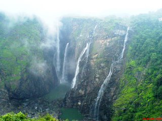
India’s highest and most spectacular falls, on the Sheravati River. There are four distinct streams: Raja, Rani, Roarer and Rocket (Don’t ask me which is which). Depending upon the gate movements of the nearby dam, the appearance of fall could range from Niagara Falls (during Monsoons) to a mere trickle. A few dare to descend down by stairs for half an hour to cool off under the Falls after which climbing back up all those stairs looks Himalayan. When in full spate, fall’s lower reaches are out of bounds. The place has reasonable facilities of a few lodges, one restaurant, and a small shopping complex.

We arrived in evening at 1730 and just-in-time to catch a few pictures before Jog Falls became the Jog Fogs. A sudden spate of rainfall brought us under a nearby cow-shed. Now, the Indian Cow is curious in her own ways and is naturally to be pardoned for their interest at our rucksack! We boarded the lone private bus to Mangalore at 2030, which thankfully started from Jog Falls only and reached Mangalore at 0400.

How to reach:
Murudeshwar and Gokarna are 160 and 250 kms north of Mangalore respectively on the National Highway to Madgaon (Goa). Few passenger trains stop at the local stations. One is from Mangalore at 0730 and reaches by 1100 at Murudeshwar and 12:30 by Gokarna Station (from where the Gokarna beach town is 10 kms.)

Jog Falls are situated between Honnavar (61 kms) and Sagar towns. No trains reach these hills naturally. But excellent Bus connectivity is there from capital Bangalore and Shimoga town. Infact, all buses plying between Mysore/Bangalore and Goa pass through this National Highway No. 204 on which lies the Jog Falls.

Saturday, September 02, 2006

KERALA -> Bekal Fort


Bekal is a complete 1-day getaway, cached away in North Kerala and boasts of the following:
  • Bekal Fort
  • Bekal Beach
  • Aqua Park for boating
  • Dense forested landscapes for trekking and picnics
Location: Bekal is a beach village, Kerala's northermost district of Kasargod. The town of Kasargod is 25 kms to the north, from where 50 kms further northwards, lies the port-city of Mangalore (Karnataka state). To the south of Bekal village, at 90 kms, lies Kannur town.

How to reach: Simple. As Konkan Railways is only a decade old in this region, bus service is excellent. From Managalore, buses to Kasargod district are every 10 minutes (1.5 hrs). And similarly from Kasargod to Bekal (0.5 hrs).

Though, only a few trains stop here - they are an excellent option for the view of the Western Ghats (lush forested hill-range extending right across the length of western Indian coastline). A train passes Kankanadi (10 kms from Mangalore) at 0715 and reaches Bekal at 0900. A return train passes Bekal station at 1730 and reaches Mangalore City Station at 1900. Cool!

Shiladitya Chakrabarti from Bangalore and myself from Mangalore undertook the Bekal trip on 27 Aug, 2006. We reached here by bus and returned by train.

Bekal Fort (I guess, timings are from 0900- 1700) is some 350 years old and a member of the family of sea-ports which dot this countryside from Kumbla to Kannur. It has exchanged quite a few hands from Kolathiri Rajahs to Hyder Ali to Britishers, and is currently cooling off in the care of ASI. The fort has cannon mounts and underground tunnels and excellent view point overlooking the Arabian Sea and the Bekal Beach.
A point to be in kept in mind is that the fort has no trees and a cap comes very handy against the sun-shine. Ditto for lunch and snacks, for the fort offers little facilities.

Bekal Beach - is only 700 metres south of fort and enroute the Bekal Park (under construction) and Bekal Station. The beach is serene and alluring and the local fishermen community, offloading fishes and playing a rond of card-games is friendly. The beach can be approached from the road and also directly from the Fort by walking along the sea-side. The Bekal Railway Station is thus only 1 km away. It is the smallest railway station from which I have caught a train and very uncharacteristic in the sense that there is neither a tea-stall nor any vendor. Just a small station room and a few passengers, and the train stops long enough for you to hop in.

Konkan Railays offers such speactacular views as the those shown below: Let the pics talk...


Wednesday, May 24, 2006

KAR.-> Kodachadri & Mookhambikay Temple (Kollur)

Kodachadri (Karnataka, India) is a famous trekking cum religious spot in the Shimoga district. It is religious as it has been one of sage Shankaracharya’s many meditation-sites and a temple of Koduchadri is there at the hill-top surrounded by only a hamlet of priests, and it is trekkers’ haven as it is a dense Mookhambikay Wildlife Sanctuary interspersed by grasslands and openings to provide panoramic views of forested valleys and lakes.

Koduchadri is accessible from nearby town of Kollur (Karnataka) by a jeep-road (15 km), though the trekking option is more popular and I with my pal undertook it.

KOLLUR - The base-town for the Trek
Kollur is a religious town some 2.5 hours away from Udupi town. Udupi is a prominent town on NH-17 in the stretch between Mangalore City and Karwad. Buses are destined to Kollur every 15 min from the private (SBI) Bus Stand in Mangalore (134 kms, 4 hrs, Rs 67). Thus, we arrived at Kollur at noon and headed for the main Mookhambikay Temple (Closed between: 1:30 – 3 pm). Mythologically, the Goddess had killed the Mokhasur demon and hence the name. As all the temples set up by sage Shankaracharya have the priests of his sect, hence the Malayali influence is noticeable.

Karikatta - The Trek begins from here...
The trekking starts from a point or a bent in the road called Karikatta - 20 kms from Kollur. From Kollur, the buses to Karikatta leave around 2, 2:30 and 3 pm. Hence, by 2 pm, we had seen Mookhambikay Temple, done Lunch and had replenished all stocks and viands – water, fruits, mosquito repellants, batteries etc. as the journey onwards were to be a solitary one. We boarded the bus and reached Karikatta at 2:45 pm. This point is unmarked and uninhabited and hence very difficult to spot for the uninitiated, but for the bus-conductors. Fortunately, two more Malyali pals (from the Kerala state) also got down from the bus and four of us then entered the jungle trail. It is a dense Mookhambikay Wildlife Sanctuary through which this jeep-track winds its way for 4 kms.

Santosh Restaurant - is halfway, and climb begins from here...
At the end of this jeep-track, there is a lone restaurant, quite a landmark for this place called Santosh hotel. We had tea here and refilled our water-bottles from the rivulet.Now began a rather steep climb for another 4 kms. It was the most exhausting thing I had ever undertaken, and perhaps in a way, my ignorance about this sheer climb was bliss or else I might have baulked earlier. While the beaten path was clearly visible, it was narrow and riddled with slippery stones, broken trees and fern-leaves which may cause skin-rash. During rains, it is muddy and full of leeches as well, but not now. Still, we had packed some salt with us. The route went through inspiring forested and mountainous landscapes, dense jungles, open grasslands and hair-raising precipices, while the sun fumed on our heads. Managing a very sporty pace, we reached temple by 5 pm. Eight kms in 2 hours!

KODACHADRI - The Temple
A small PWD guest-house has two arrangements here next to the Temple: rooms at Rs.250 and sleeping mattresses on floor for Rs.25. Since, we also had our own bed-sheets, the latter suited us well. After booking the arrangements for night, I thought we were headed for the nearby water-falls and hence departed bare-footed like all others but our Malyali pals suddenly changed plans and decided to watch sun-set over the mountain-top, which meant another journey of 1 km to the mountain peak. Bare-footed climb over sharp and tooth-sawed earth, it was the single most excruciating experience I have gone through in my life. Nevertheless, the sunset was inspiring and several teams of trekkers enjoyed it. The night fell swiftly over the valley so that the descent of even a km took time.
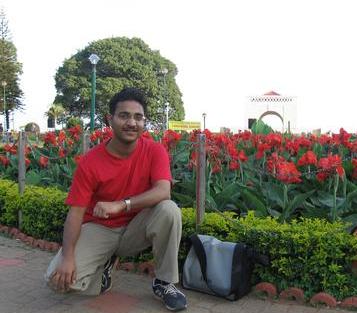
The next morning was the most auspicious day of Shiv Ratri and the entire temple complex was cleaned and festooned with banana leaves. We rose early to capture the sun-rise in our cameras and hearts. How the sunlight dispels the mist and how pristine is the valley that lies further! A quick breakfast and we descended back from Koduchadri the same way, bidding adieu to our Malyali pals. The return journey is more treacherous as one has the sight of ruthless fall over the precipices as a frequent companion. A small slip at the wrong place and Mohit was an adventurous and a bright young man, beloved by all. The descent too took 4 hours (the same time as climb)!! Throughout the descent, groups of local boys and girls dressed in their best clothes were making for the temple in the morning and a few jeeps also came our way. Today was the restaurant’s day of the year.

Return Journey
We soon reached Kollur and then caught a bus for Udupi town where we lunched and headed for the Malpe beach. Along with Ullal / Summer Sands Beach in Mangalore city, this is the beach with the most facilities in all of South Karnataka with a youthful crowd from nearby Manipal Medical College and Surathkal REC to boot! And we were soon kissing the surf, only to dry the clothes lying on the bench for another 1 hour. The island of St. Mary is near and the boat for it can be boarded from the nearby docks (1.5 km) but unfortunately as we realized, only before 4:30 pm. So we returned for the Mangalore city

Tuesday, May 16, 2006

KAR.-> Coorg -> Madikeri & Kushalnagar

KODAGU (Karnataka, INDIA) also known as Coorg, is a hilly district nestled between the states of Karnataka and Kerala. It is known for its coffee, spices, mountainous beauty and gallantry. It is also special in that the natives are not belonging to the local stock and have their own customs and heritage. The district HQ (earlier the capital of Bristish estate) is Madikeri.

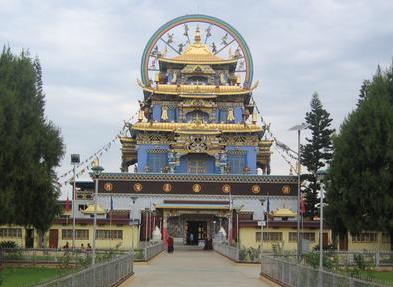
The picture to the right is of Namdroling Monastry, Kushalnagar, Coorg

MADIKERI: District HQ

Madikeri was earlier known as Mercara. It is 110 kms from Mysore, 140 from Mangalore and 250 from Bangalore. Madikeri commands a towering view of the faraway valleys from its vantage point over a mountain.

Fort
is at the heart of the city. This small fort has been entirely converted for administrative purposes. There is only a Church converted into a small museum, inside the fort complex for public viewing. The district jail and a reverred temple is at the base of the fort. A Britishers installed commommeration statue is also at the fort's base in memory of the valour of soldiers during World War II.

Rajah's seat & Park- is half a kilometre further from the Fort. It is a picturesque garden with a small canopy at one end (dimly visible in the picture), from where the Rajah had the panormic view of the valley below. Today, the people throng the beautiful garden in the evening for the sunset.

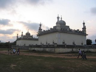
Gaddige is a kilometre away from the city-centre in another direction. It is the royal burial ground. There are two identical big tombs with staircase up to the top.

Talacauvery (origin of river Cauvery) and Bhagmandala are other must-see points in Coorg district. They are 1 hour journey from Madikeri, part of which is on the route to Mangalore city. Personally I could not visit these.


KUSHALNAGAR: A better night halt than Madikeri

Before we realized, it had grown quite dark in Madikeri. As the plan was to see the herds of elephants early up in the morning in Dubare Elephant Camp, we enquired for a taxi to there, which is some 45 kms far, and also if hotel was available there. At once, the taxi-driver opened the door which was how we became suspicious in the first place. Oh, so he expected us to offer Rs. 600 to him (and without even being at gun-point) as the return journey too has to be paid like it or not, and besides there is no guaratee that rooms will be vacant in the only hotel there is at the camp. We thanked him for the information and cut the chase to nearby govt. Bus Stand and headed for Kushalnagar Around 19:30 pm, the bus arrived and me managed to find space enough to stand. Kushalnagar is another town 35 kms to the north of Madikeri, though smaller in size. It is in the plains and hence travelling is faster and smoother. This town is approached first when one is headed to Madikeri from Bangalore or Mysore and hence is well-connected too.

We reached Kushalnagar and had an excellent dinner and checked in a hotel (Rs 250 for double-bed room). Next morning we began early to take advantage over the tourists which will be swarming in bigger numbers in cars and buses from Madikeri. And here is the advantage of Kushalnagar over Madikeri, as the night halt. It is cheaper, more accessible by road, and nearer to some scenic locales such as the following:

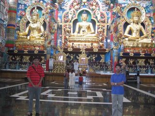
Namdroling Monastry is 3 kms on the other side of Kushalnagar. It is the biggest community of Tibetans in South India. The temples are simply awe-inspiring and the culture is so unique. The main temple has gilded statues of Lord Buddha in the centre (60 ft) with Guru Padmasambhava and Guru Rinpoche (both 58 ft) on left and right of him. Besides, the elaborate paintings of 25 disciplines of Guru Padmasambhava, adorn the walls. Many a tibetan tales are told in the form of paintings. We paid a visit to their library and all books and manuscripts are covered in ochre cloth and bound by strings. The academy has several students coming from their nearby hostels in red dresses , and reciting their morning lessons in the classrooms.

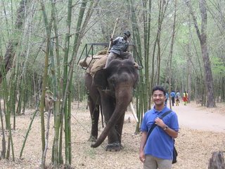
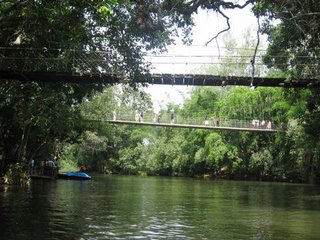
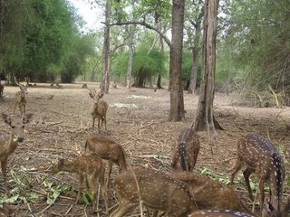
Nisargdham Park is 3 kms way and is on the banks of Cauvery. Covered with Bamboo forests, it offers pedal and row boating, long hanging bridges to cross, wooden platforms and tree-houses to explore, elephant-rides to be enjoyed and herds of deers to feed.

Dubare Elephant Training Camp - is 12 kms further from Nisargdham. Here a herd of 15 elephants come for the bathing by Cauvery between 10 - 12 am and then again turn up between 4 - 5 pm. In other times too, one might be lucky to catch a glimpse of a few elephants coming over for food and bath. The tourists too get to splash around in the shallow-flowing Cauvery river, gently tumbling over the rocks. Elephants can be bathed personally and jumbo-rides are also arranged. One point in mind: the road to the elephant camp is quite broken in certain patches.

Hirangi Dam is some 7 kms from Kushalnagar but I personally did not go there as it was the dry season. The Dam's beauty is in post-Monsoon season in the months of September or October.

Sunday, April 02, 2006

KERALA -> Ernakulum, Cochin, Allapujha & Kottayam

Middle KERALA (India): God's own country
In middle and southern Kerala, there exists such a network of back-waters, rivers and canals that Venice should be called the 'Kerala of the West'. Of all these, the 70 kms long balloon-shaped Vembanad Lake is the biggest. At its inception, it divides the region into Allapujha and Kottayam districts and as the lake empties into the Arabian Sea, it divides the port-city in two: Kochi(towards sea) and Ernakulum ( towards interiors).
25 March 2006

Kochi-Ernakulum
Kochi -Ernakulum is the Jewel of Kerala. The city has three railway stations, separate domestic and international airports and a port, and is even bigger than the Kerala's capital - Trivendrum. I arrived at Ernakulum on Saturday along with a pal by train. We headed for the Main Jetty (from where one gets the ferries) which is between Marine Drive and Children's Park and from there reached Kochi by jetty. On setting foot, we set out for St. Peters Church. Kochi is groupable in Fort Area which includes the Christian buildings and offices though no worthwhile fort remains today, and Matencherry Area which has the busier town.
Kochi: Fort Area
Chinese nets - is a popular artifact to be admired. The huge cantilever-like nets catch fishes during the rise and fall of tides. Sheer ingenuity!!
St. Peters Church is attributed to be the oldest in India and was built by Portuguese in 1503. It once housed the tomb of Vasco da Gama for 14 years before it was shifted back to Lisbon. Later, the church exchanged hands between the conquerors: Dutch and English and different Christian schools too.
Dutch Cemetery is half a kilometre further and lies in decrepit state. While Bristish, French or Portugese cemetries are there in quite a many places, a Dutch cemetry is a rarity in India.
Indo-Portuguese Museum is half a kilometre further from Dutch cemetry. It is within the Bishop's mansion and was set up by Portuguese assistance. It exhibits clerical vestments and memorabilia like dresses, figurines, bibles etc. A British hydrorapher's map of Kerala made in colonial times just had me rooted there - it was so large and so detailed! The place also has a shop selling aromatic cosmetics - a Keralite specialty.
Santa Cruz Basilica had Italian artists’ roof-paintings and a copy of Last Supper as well. We requested a clerical person to shed light on some of the clerical terms. And thus I came to know that while a church has a father, every few thousand Christian families in a region have a Bishop whose church is Cathedral. A church special for some reason: treasures, antiquities, architecture, heritage etc is elevated to a Basilica, done so only by the Pope, the head of Roman Catholic Christdom. India has a Basilica in Old Goa and one here in Kochi – Santa Cruz Basilica. Also, whenever the sightings of Mother Mary are confirmed (like those of Devi Durga), often the nearby church is re-christened as Mary after the name of the local community or some other beatific name.
The lanes of Kochi Fort Area are all Goan: queer inns and pubs, inviting restaurants and emporiums of Indian works of metal, wood and textiles which all foreigners peek into.
Kochi: Matencherry Area
Jews-town - is an important locality here with their synagogue (unfortunately closed on Saturday) and the markets famous for old trade-houses of spice, rubber and cashew existing to this date.
Dutch palace - was actually built by the Portuguese in early 16th C to pacify the local ruler, and only later reapaired by the Dutch. It has on showcase: maps which indicate 5 different variations of Kochi's spellings, wall-frescos including a rather alarming verion of Lord Krishna with Vrindavan gopis (belles) in the basement, palanquins, armaments and portraits of Verman dynasty’s kings charted from 1500 to 1960s whereafter the last ruler Kerala Varman abolished the title.
We returned by bus to Ernakulum. I did some shopping in Ernakulum for books. The city has some great malls besides the Marine Drive – a popular youth-spot in the evening.

26 March 2006
ALLAPUJHA (locally called Allaporha, earlier called Allepey)
.
From Ernakulum, we arrived here on Sunday (2 hrs) by bus. It is well-connected to Kochi by an express highway. It has two canals (North and South) in which the North canal has the main jetty( the point to take ferries). Boats are of three types here: Government ferries connecting rural inland-islands, houseboats preferred by foreigners for a cruise for many days and Motorboats for a few hours. There are also non-motorised oared boats as well. We experienced a motor-boat ride and took a round of nearby villages where Ayurvedic resorts constructed besides the canals, offer spirituality and health to their seekers. The place is the venue of annual and much-celebrated Nehru Boat Race. Then we boerded the govt. ferry to Kottayam. It takes 2.5 hours, is cheap and relaxing if one can get used to the motor-sound. It ferries some 100 people, half emptying out in nearby villages itself. The landscape I witnessed put the Dil Se movie's song to shame. Believe me!! Our ferry coursing through narrow canals cut across shoals of ducks, floating beds of flowered hydracinths which were miles-long and dense, and excited local kids running along, for many have ferry as their sole means of travel. Meanwhile, I struck a conversation with an Argentinian and read Thomas Friedman's ‘The World is Flat’.

KOTTAYAM
Kottayam – is the cultural capital of Kerala. It has a famous Shiva Temple where an annual festival is held with gold finery-bedecked elephants and colorful umbrellas. Unfortunately, the temple and the two adjacent churches of Cherriapally and Veliapally were both closed – Sunday afternoon being the nap-time. The Veliapally Church is built atop a hillock is tranquil and inspiring. It overlooks the lush forests and canals and from here one can see below, the life in the village down the hillock. The Cherriapally Church was having some clerical election. So, we returned back to Ernakulum Bus Stand by bus (nearly 2.5 hours) just-in-time to catch our bus to Mangalore from the same Ernakulum Bus-Stand. (470 kms, 11 hours)
Monday, February 06, 2006

NEW DELHI -> Akshardham Temple

AKSHARDHAM MANDIR, NEW DELHI
Monday closed. Tue-Sunday Timings: Temple – 9 AM – 9 PM; Exhibition – 11 AM – 9 PM
Things Allowed: Water, Hand-held Purse.
Things not allowed: Bags, eatables, mobiles, cameras. Deposition counter available.
The metallic objects like belts, coins etc. are momentarily removed and returned back.
Parking: Adequate – (guess) more than 500 cars and 50 buses!!
Nearest: Bus-stop – 0.5 km far at Noida Mod Flyover. “Pre-paid auto stand” is nearby only.

Dedicated to the Swami Narayan God, the Akshardham Temple is made in the Gujrati-Rajwara architectural style. If Taj Mahal is kavita (poetry) in marble, then Akshardham Temple is a pooja (prayer) in light-pink sand-stone. It is a must-visit place for seekers of spirituality, craftsmanship and tranquility. It took 7000 artisans nearly 5 years to construct it. The Swami Narayan sect has temples in London, Chicago and of course in Ahmedabad where the infamous terrorist attack had taken place. Natutrally, the security has always remained beefed up since then. The message delivered is of simplicity in life, respect and love for all and for search for inner beauty and strength.

[Incidentally, the Bachchan Family, Nandas (In-laws of Bachchans and owner of Escorts) and Amar Singh had visited in the morning of the same day, as I had chosen.]

The complex can be broadly divided into three: The temple, the exhibition and the other facilities.

TEMPLE
The central dome is erected on a high pedestal and has four doors. The statue of Lord Swami Narayan radiantly faces in the direction of the on-lookers from the East door. The statue, 11 foot tall and over 2 tons in weight, is made of metal and then gilded. The articles of Lord are shown in glass cases behind the statue. These include: slippers, footprints, etc. Colored statues of Sita-Ram and Radha-Krishna are also in the vicinity, as well as wall-paintings depicting the Swami Narayan’s biography. The parikrama (walk-around) can be done inside the dome as well as outside it. The Temple is surrounded on the southern side by a pond with 108 gau-mukhs (Heads of cows denoting the 108 rivers of India) offering water in it. On the other side of this pond, is another enclosure where offerings are made to Swami’s statue and prashad (holy-alms) is received. This is a very beautiful arrangement, as it keeps the surroundings clean from unnecessary flowers and prashad strewn over the floor as is the case in most temples.

EXHIBITION
The exhibition depicts the message and life of Swami Narayan. It is so artistically and technically superb that one wonders all the while if one is in India and that too in a temple. Indeed, 3D animations surround sound, moving Hubots, temperature and humidity simulators… The exhibition can be watched with the shoes on. There is a ticket of Rs.75 for children below 12 and elders above 65, while it is Rs.125 for adults. The exhibition is in three stages:

The Light and Sound Show Hall: 40 minutes
It comprises of four or five sittings of some 7 minutes each. The first entry is done in batches of 50 each, every 8 or 10 minutes, and the same batch moves uniformly inside the hall together. The theme is the life of Swami by the media of dynamic exhibits, light & sound show. Honestly, words are useless to describe the beautiful effects generated and how they affect the sub-conscious mind…

The cinema: 40 minutes
A 1000 seater hall shows a very touching and moving tale of Swami Narayan’s life and the message of BAPS – the society which is entrusted to forward the values among society. By the time one movie-show ends, enough batches of the previous hall-show have not gathered and hence one may have to wait initially for the film to start.

The Boat-Ride through Indian Civilization: 10 minutes
Now, there is nothing like this I had ever envisioned, leave alone having seen!! The ride takes place inside a mechanical driven and auto-piloted boat (batch of some 18 people at one time) inside an underground ring-shaped water-canal and on both banks are the stills and images of the vast and ancient Indian culture. The theme is the advances Indian civilizations made in its past and how we should further add onto it. There are stills from village-life, Panchayat Raj (Rural Democracy) and Vaastu art in India in 5000 BC. Hubots of many swamis and rishis (sainta and savants) are shown expounding on the mathematical, medical and astronomical treatises. The entire gamut of Indian culture from Ajanta Caves to Bharat Natyam (dance form), from saints to singers and from science to spirituality is well-illustrated and made life-like.

Did you know that Indians were the first to discover the following?
Numerals, significance of 0 (Aryabhatta),
Trigonometry, root of quadratic equation,
Solar system and planetary motion (Aryabhatta had stated what Copernicus said much later.),
Surgery (Sushruta and Shalya) and herbology (Anesthesia was known to Indian doctors millenias earlier.),
Designs of airplanes and buildings (Vaastu),
Unique smith’s work (Ashokan Pillar is rust-proof but we still don’t know why??)
Gravity (Even I was surprised that a rishi (saint) had stated the same principles of gravity much before Newton, by having observed the same phenomena as he had).
Martial Arts (It is a known fact that South Indian martial artists had taught Chinese scholars centuries earlier of this. Similarly, a Bengali scholar was invited in Himalayas to establish what came to be later known as Tibetanism)

LIFE OF SWAMI NARAYAN BHAGWAN
He was born in 1781 in a Brahman family in Chhapiya, 60 kms from Ayodhya (Uttar Pradesh). Taught by his father, who had later shifted to Ayodhya, and many saints and pujaris, he soon mastered the Vedas and Upnashidas.

At the age of mere 11, he did grih-tyaga (left home) and offered himself to the path of nature and enlightenment. He left in a stormy rainy night with nothing more than a loin-cloth; and swam across the flooded Saryu to leave Ayodhya far behind before morning. He called himself “Neelkanth” on this journey. He reached Har-ki-pairi (Haridwar) and followed Ganga upwards to Kedarnath. From there onwards he reached Badrinath across the Valley of Flowers. Despite the urges of the Pujari there, he left for Kailash Mansarovar when it was the onslaught of winter season – throughout all this barefooted, and with no woolens!! From Kailash, he crossed the mighty Kali River and traveled across the deepest ridge in the world, of Annapurna Range in Nepal. Here he perfected the toughest Yoga aasan –Ashtang Aasan and did penance. He finally reached Assam and humbled a few Tantriks (Practitioners of occult science) in Kamakhya Mandir and then toured further eastwards in the hills of Nagaland and Manipur.

Like this he traveled all alone throughout the Indian peninsula’s coast – and finally reached on 21 July 1999 at Lochkam, Gujrat. His mastery of yoga and divine presence awed the disciples of Swami Ramananda Ashram and they invited him to the Ashram. Swami Ramananda, who was not there then, was well-known in the region for his devotion and services for the poor and hence Swami Narayan agreed to this proposal and thus halted his mammoth 12000 kms long journey. He was 14 then. He did all the rituals in the Ashram as a devotee and when finally the two Swamis met, there was all happiness and blessings all around. Swami Ramananda told his followers that the person he often alluded to as the God who was destined to his Ashram, has finally arrived!

Swami Ramananda offered his chair and duties to Swami Narayan when he turned 25, and left. Swami Narayan then served the needy and established hope in the region. He died in 1830, at the age of 49 years.

OTHER FACILITIES
There is a free check-up clinic run by BAPS society and a large Bhojan-griha with diverse palates in mind from Dosa and paratha to Burgers, Pizzas and chatpatas. There is also another huge hall with all kinds of souvenirs like books, cassettes, CDs, statues, mandirs, watches, clocks, incense-sticks, clothes and garments, food-items, beads, shawls etc. Besides, there are small snacks counters in such locations as near the queuing positions in front of each hall.

PERSONAL TIP!!
Go on a week-day and see the entire temple-complex within 4 hours, without a hassle. Best time is to reach there is at 10 am and first see the temple and then the the exhibition which begins at 11 am. Alternatively, see the temple one day and the exhibition some other day. Whatever you choose, the point is that trying to see the exhibition on a holiday is foolhardiness and also a big strain on temple’s volunteers.